
EXISTING SITE CONDITIONS
|
The SR-60/Theodore Street interchange was constructed in 1964. The existing interchange consists of the Theodore Street overcrossing with eastbound (EB) and westbound (WB) SR-60 entrance and exit ramps. Theodore Street Overcrossing (PM 21.37, Bridge Number 56-0488) is a four-span precast concrete stringer structure. It is approximately 234 feet long, 38 feet wide and spans four lanes of traffic on SR-60. The interchange shares characteristic with Type L-6 and Type L-7 two-quadrant cloverleaf interchanges. It is configured with hook ramps but, rather than terminating at parallel streets, the ramps terminate at Theodore Street. The existing ramp terminal are stop-controlled.
Existing development in the immediate vicinity of the interchange includes rural residential developments along the east side of Theodore Street, between SR-60 and Ironwood Avenue, and the HIghland-Fairview Skechers facility located adjacent to the south side of SR-60, between Redlands Boulevard and Theodore Street. Proposed development in the area includes the World Logistics Center, a plan for the development of up to 41.6 million square feet of modern high-cube logistics warehouse distribution facilities on approximately 2,665 acres of land located immediately south of the SR-60/Theodore Street interchange. There will also be future development such as a residential area north west of the interchange and an industrial area south east of the interchange. Due to future development, it is necessary to accommodate non-motorized traffic such as pedestrians, bicyclists, and equestrians due to the City’s designated equestrian trail. |

Highland-Fairview Skechers Facility
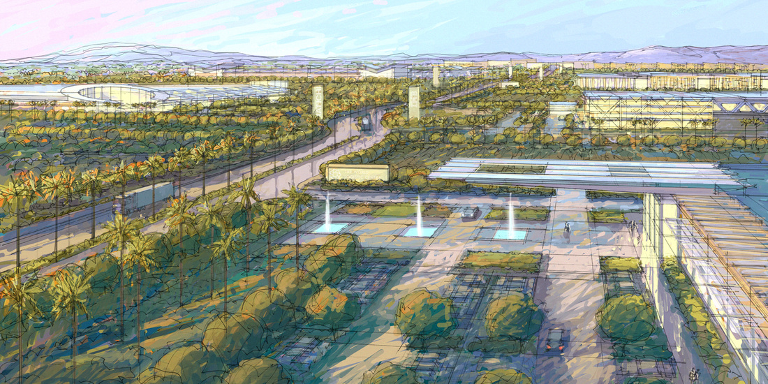
Proposed World Logistics Center
|
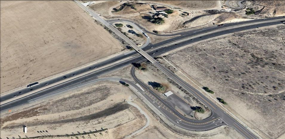
Existing Theodore Street Interchange along SR-60
CURRENT DEFICIENCIES
The deficiencies of the interchange at SR 60 and Theodore Street include tight radii on the hook ramps that make traversing them in a semi-truck difficult. Currently the majority of trucks in the area head north to the Badlands Sanitary Landfill. The trucks are generally full and require a significant amount of time to reach the speeds of the local road. The current configuration is a two-way stop. Traffic from the ramps is required to stop before proceeding. This is especially difficult for trucks to clear the intersection in a timely manner.
In the future there is a proposed project for the city of Moreno Valley that will include a 40million square foot facility called the World Logistic Center (WLC). This project will significantly increase the amount of trucks in the area. This will in turn impact the interchange. Figures 4 and 5 show the locations of the studied intersections and their respective future turning counts. In its current state the hook ramps would not be adequate to accommodate for the increase in traffic. The interchange project is expected to be completed in 2017.
Along with the WLC project, the City of Moreno Valley is expected to increase in population. To accommodate for this, the master plan has set aside land for residential development to the north of SR60. In the north there are multiple small ranches, some of which provide healthcare, housing and/or training for equestrians. The city has accounted for the equestrians by indicating equestrian trails in the master plan. Currently the plan includes an equestrian train on Theodore Street that will need to be accounted for in the design alternatives.
GENERAL NEED
The City of Moreno Valley has identified the need for operational and capacity improvements at the SR-60/Theodore Street interchange. The City and Caltrans are members of the Project Development Team (PDT) and have been involved in the development of the purpose and need statement for the project.
